File:Modeled-map-of-the-yearly-averaged-world-wind-speed-m-s-at-100-m-above-sea-level.png
Size of this preview: 800 × 432 pixels. Other resolution: 850 × 459 pixels.
Original file (850 × 459 pixels, file size: 378 KB, MIME type: image/png)
Summary
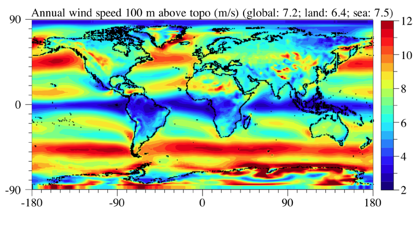
World map of wind speeds. Source: Jacobson, Mark & Delucchi, Mark. (2022). Evaluating the Feasibility of a Large-Scale Wind, Water, and Sun Energy Infrastructure.
File history
Click on a date/time to view the file as it appeared at that time.
| Date/Time | Thumbnail | Dimensions | User | Comment | |
|---|---|---|---|---|---|
| current | 21:57, 29 March 2023 | | 850 × 459 (378 KB) | Elie (talk | contribs) | World map of wind speeds. Source: <cite>Jacobson, Mark & Delucchi, Mark. (2022). Evaluating the Feasibility of a Large-Scale Wind, Water, and Sun Energy Infrastructure.</cite> |
You cannot overwrite this file.
File usage
The following page uses this file: