File:population-earth1.png

Size of this preview: 800 × 400 pixels. Other resolution: 1,600 × 800 pixels.
Original file (1,600 × 800 pixels, file size: 371 KB, MIME type: image/png)
Summary
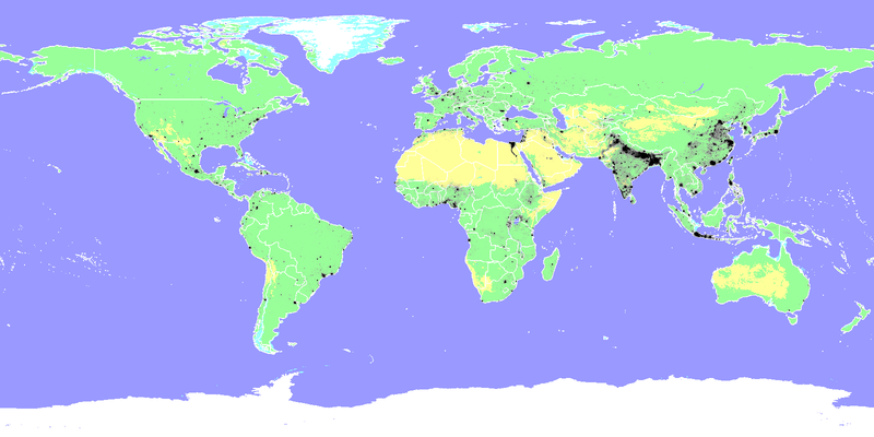
An isochromic map of the world population, superimposed on a pastel-color background that shows land, water, and borders.
Everything in black is population.
Note: Some border lines may be completely obscured by populations (especially India's borders with Bangladesh, Pakistan, and Bhutan). Still better than the opposite (letting the border lines obscure the populations).
File history
Click on a date/time to view the file as it appeared at that time.
| Date/Time | Thumbnail | Dimensions | User | Comment | |
|---|---|---|---|---|---|
| current | 03:52, 7 August 2022 | | 1,600 × 800 (371 KB) | Elie (talk | contribs) | An Term:isochromic map of the world population, superimposed on a pastel-color background that shows land, water, and borders. Everything in black is population. Note: Some border lines may be completely obscured by populations (especially India's borders with Bangladesh, Pakistan, and Bhutan). Still better than the opposite (letting the border lines obscure the populations). |
You cannot overwrite this file.
File usage
The following 2 pages use this file:
- Wind power/Geography
- File:Population-earth1.png (file redirect)